Nkhaba
Nkhaba is an inkhundla of Eswatini, located in the Hhohho District. Its population as of the 2007 census was 15,704. Areas under Nkhaba are Jubukweni, Mhlosheni(formerly Forbes Reef) next to Malolotja Game Reserve, Hawane, Mahebedla east and west, Mnyokane, Malanti, Luvinjelweni etc. It is one of the coldest places in Eswatini.
* Statoids.com, retrieved December 11, 2010
* Statoids.com, retrieved December 11, 2010
Map - Nkhaba
Map


Country - Swaziland
 |
 |
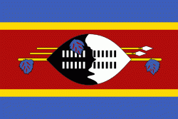
| Flag of Eswatini | |
The population is composed primarily of ethnic Swazis. The prevalent language is Swazi (siSwati in native form). The Swazis established their kingdom in the mid-18th century under the leadership of Ngwane III. The country and the Swazi take their names from Mswati II, the 19th-century king under whose rule the country was expanded and unified; its boundaries were drawn up in 1881 in the midst of the Scramble for Africa. After the Second Boer War, the kingdom, under the name of Swaziland, was a British high commission territory from 1903 until it regained its full independence on 6 September 1968. In April 2018, the official name was changed from Kingdom of Swaziland to Kingdom of Eswatini, mirroring the name commonly used in Swazi.
Currency / Language
| ISO | Currency | Symbol | Significant figures |
|---|---|---|---|
| SZL | Swazi lilangeni | L | 2 |
| ISO | Language |
|---|---|
| EN | English language |
| SS | Swati language |